CESDb > Water Resources > HEC-RAS
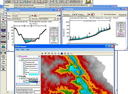
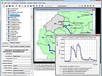
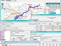
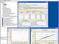
HEC-RAS screenshot
SOFTWARE :HEC-RAS
VERSION :6.0
PLATFORM :Windows
FILE SIZE :743.96 MB
LICENSE :GNU General Public License
DOWNLOADS :UserDownloads:9475
Program Description

HEC-RAS is designed to perform one-dimensional hydraulic calculations for a full network of natural and constructed channels. The following is a description of the major capabilities of HEC-RAS.

The HEC-RAS system contains four one-dimensional river analysis components for: (1) steady flow water surface profile computations; (2) unsteady flow simulation; (3) movable boundary sediment transport computations; and (4) water quality analysis. A key element is that all four components use a common geometric data representation and common geometric and hydraulic computation routines. In addition to the four river analysis components, the system contains several hydraulic design features that can be invoked once the basic water surface profiles are computed.

  • Steady Flow Water Surface Profiles
  • Unsteady Flow Simulation
  • Sediment Transport/Movable Boundary Computations
  • Water Quality Analysis

* HEC-RAS download link provides gnu general public license version of the software.

Similar Software
HEC-HMS Version:4.7.1 · Hydrologic Engineering Center
HEC-HMS

Hydrologic Modeling System

The Hydrologic Modeling System (HEC-HMS) is designed to simulate the complete hydrologic processes of dendritic watershed systems.

HEC-ResSim Version:3.1 · Hydrologic Engineering Center
HEC-ResSim

Reservoir System Simulation

The Reservoir System Simulation (HEC-ResSim) software is used to model reservoir operations at one or more reservoirs for a variety of operational goals and constraints.

HEC-SSP Version:2.2 · Hydrologic Engineering Center
HEC-SSP

Statistical Analyses Of Hydrologic Data

Statistical Software Package (HEC-SSP) developed by the Hydrologic Engineering Center. This software allows you to perform statistical analyses of hydrologic data.

HEC-FIA Version:3.1 · Hydrologic Engineering Center
HEC-FIA

Flood Impact Analysis

The HEC-FIA Flood Impact Analysis software package analyzes the consequences from a flood event.

HEC-FDA Version:1.4.2 · Hydrologic Engineering Center
HEC-FDA

Flood Damage Reduction Analysis

The Flood Damage Reduction Analysis (HEC-FDA) software provides the capability to perform an integrated hydrologic engineering and economic analysis during the formulation and evaluation of flood risk management plans.

Comments & Reviews
Steve Wilson
★★★★★
Great software, thanks! By the way, try out GeoHECRAS too, working good for my projects.

Submit a review about HEC-RAS software with your social media profile

avatar
Rate This Software

HEC-RAS has been rated 4.1 out of 5 points. A total of 11 votes cast and 1 users reviewed the software.

Popular Programs

4147 hitsHEC-HMS 4.7.1

The Hydrologic Modeling System (HEC-HMS) is designed to simulate the complete hydrologic processes of dendritic watershed systems.

3888 hitsPMWIN 5.3.3

Processing Modflow version 5. 3 is included in the first edition of the book 3D-Groundwater Modeling with PMWIN published by Springer-Verlag.

3647 hitsAquiferWin32 6.0

Aquifer test analysis is an integral part of groundwater modeling, supplying critical hydraulic parameters to the model or other basic groundwater calculations.

1659 hitsStrater 5.7

Strater is a powerful and innovative well log, borehole and cross section plotting software package for geoscientists.

New & Updated

19 AugDEWATER 1.0

This Excel spreadsheet refers to the dewatering design during construction and calculates the settlements of neighboring buildings.

24 DecSMS 13.1

SMS (Surface-water Modeling System) is a complete program for building and simulating surface water models from Aquaveo.

10 DecWMS 11.1

Aquaveo WMS (Watershed Modeling System) is a watershed computer simulation and modeling software application from Aquaveo. WMS is a all-in-one hydrologic and hydraulic solutions and pipe network tools.

3 DecGMS 10.5

GMS (Groundwater Modeling System) is water modeling application for building and simulating groundwater models from Aquaveo.